By: Diwani Ram Lohar (The author is a Section Officer at the Supreme Court of Nepal and a native of Darchula District.)
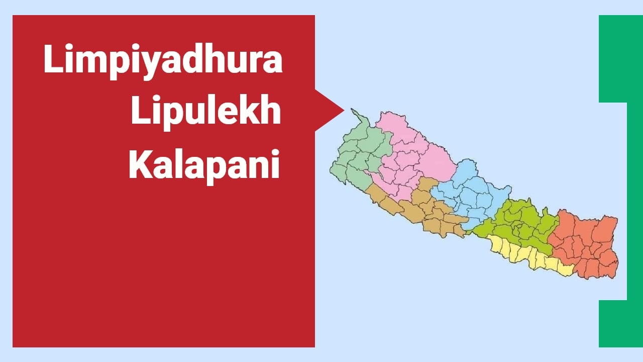
Nepal and India are two close neighbors; both countries share deep historical, cultural, and socio-economic relations from a long history. The Nepal–India border dispute refers mainly to disagreements over the exact ownership of certain territories along the 1,770 km open border the two countries share. While most of the boundary is well defined, a border dispute exists over a small but important area in the Himalayas called Limpiyadhura-Kalapani-Lipulekh. Both countries claim that this area belongs to them. The disagreement is mainly about where the border should be based on a river’s origin. This issue has been going on for the last six years and is still not fully solved.
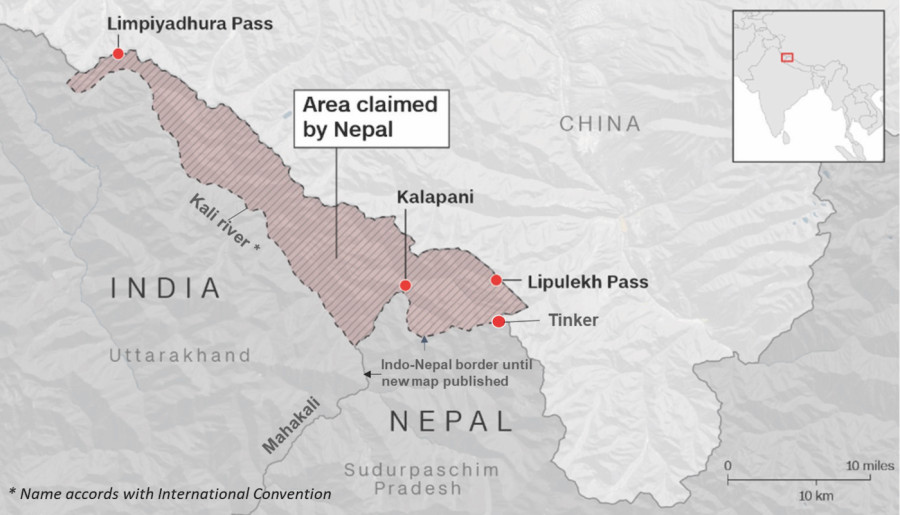
The problem started after the Treaty of Sugauli, signed in 1816 between Nepal and British India. According to the treaty, the Kali River (now known as the Mahakali River) would mark the western border of Nepal. But the treaty didn’t clearly say where the river starts. Nepal says the river begins from Limpiyadhura, so Kalapani and nearby areas belong to Nepal, specifically the Byas Rural Municipality of Darchula district of Sudurpaschim province. India says the river starts from a different point (Lipu Gad), so the disputed area falls inside India’s Uttarakhand state, Pithoragarh district. This disagreement over the river’s origin has caused confusion and tension for many years.
In 2020, India built a road through Lipulekh Pass, which connects to the China border, inaugurated by Indian Prime Minister Narendra Modi. Our country, Nepal, protested, saying the road passed through our land. In response, Nepal released a new map that included Kalapani, Limpiyadhura, and Lipulekh as part of Nepal. Nepal also updated its national emblem and constitution to include the new map. India disagreed and said Nepal’s map was not based on facts.
After that, Nepal kept asking India to sit down for talks and solve the issue peacefully. India said it was open to talks but did not accept Nepal’s new map. Recently, India and China reopened the Lipulekh trade route. This trade route passes through the disputed area, which upset Nepal again because it wasn’t consulted. Nepal still claims the area and wants India to remove its troops from Kalapani. So far, no final agreement has been reached.
For our country Nepal, it is important to protect its land, national pride, and the border line gained through the Sugauli Treaty of 1816. The disputed area is close to China, so India also takes it as important for India’s security. It is also a route used by Indian pilgrims going to Mount Kailash in Tibet.
Nepal has main and important evidence in the Sugauli Treaty (1815–1816), where Article 5 fixed Nepal’s western boundary at the Kali River. Nepal argues the true origin of the Kali River is at Limpiyadhura, not near Kalapani. If Limpiyadhura is accepted as the origin, then Kalapani, Lipulekh, and Limpiyadhura all fall inside Nepal.
Another evidence is historical maps issued by British India in 1827, which clearly show the Kali River originating from Limpiyadhura, placing Lipulekh and Kalapani inside Nepal. 1850s–1860s maps by the British Survey of India also recognize that the river flowing from Limpiyadhura is the Kali River (now Mahakali). Official maps of Nepal before 1962 consistently showed this area as part of Nepal. Although old maps confirm Limpiyadhura as the Kali’s source, India occupied Kalapani during the 1962 India-China war. The Indian army presence is recent, or after the 1962 India-China war, not historic.
In May 2015, India and China agreed to expand border trade through Lipulekh without consulting Nepal, sparking protests. When Indian PM Narendra Modi visited China on May 14, 2015, an unexpected agreement appeared: “Both sides agreed to expand border trade through Nathula, Qiangla/Lipulekh Pass, and Shipki La Pass.” This meant using Lipulekh—Nepalese land—for trade without any consultation with Kathmandu. The then-government of Nepal sent formal objections to both China and India.
Treaties are binding and must be interpreted in good faith, based on the ordinary meaning of terms, in historical context, and considering subsequent practice. Nepal insists the Sugauli Treaty supports its claim; India relies on British-era maps and administrative control. There is a principle that new states should inherit colonial boundaries at independence. India argues it continued British administrative control over Kalapani since independence in 1947. International courts often consider who has exercised continuous, peaceful, and actual control. India has maintained a military presence in Kalapani since the 1962 China-India war. Nepal argues that administrative control does not override treaty rights.
Regarding Territorial Integrity & Sovereignty (UN Charter, Article 2(4)), both countries must respect each other’s sovereignty; forceful occupation is unlawful under international law. Regarding Peaceful Settlement of Disputes (UN Charter, Article 33), negotiation, mediation, or arbitration is the proper method.
Under international law, the Limpiyadhura-Lipulekh-Kalapani dispute rests on the interpretation of the Treaty of Sugauli and the principles of treaty law, effective control, and uti possidetis juris. However, since both India and Nepal claim sovereignty, and neither wants to involve third-party adjudication, the only viable solution is bilateral negotiation with possible technical boundary demarcation.
Nepal and India relations in recent times have had a lot of ups and downs, which has particularly become noticeable since 2015. Efforts to get the bilateral relationship back on track have required moving forward together despite issues of disagreement. Around 98 percent of border disputes between India and Nepal have been resolved, and the remaining 2 percent (including Limpiyadhura-Lipulekh-Kalapani and Susta) is likely to be resolved through negotiations. The two countries should resolve the issue as quickly as possible in view of their geographical, social, and cultural proximity.
EDITORIAL NOTE
At “Kanchan Awaaz,” we believe that the border issues of Sudurpaschim are not just national headlines but lived realities for the people of this province. The article above provides a legal and historical perspective on the Kalapani issue from a local voice.
Mr. Diwani Ram Lohar brings a unique dual perspective to this debate: one of a legal professional serving at the Supreme Court and the other of a son of the soil from Darchula, the very district at the heart of this dispute. His analysis underscores that while history provides the evidence, only diplomatic maturity can provide the solution. We publish this opinion to foster healthy debate on how Nepal should navigate its most sensitive diplomatic challenge.
— The Editor, Kanchan Awaaz
प्रतिक्रिया